Thursday, July 31, 2014

Sitka, Juneau and Glacier Bay

Sitka July 15th -July 16th

Our next Marine Highway stop was in Sitka. On July 14th, we left Petersburg on the M/V Taku
Petersburg Harbor
at 3 pm and traveled around the top of Mitkoff Island through the Frederick Strait and down to Kake which is mostly a Native American village and very heavy into fishing, of course.  As night descended we continued up between Admiralty and Baranoff Islands into Chatham Strait and around Baranoff down into Peril Strait and finally into Sitka Sound.   We arrived in Sitka at 3:45 am on the 15th. We had a cabin for this 12 hour passage which consisted of a set of bunk beds and a bathroom with a shower. We did have an outside cabin so it was bright. We didn't get much sleep even though we went to bed at 8pm because the engine was noisy as were the children in the next compartment. Before that, however, we did see seals on a buoy and quite a few whales  along the way and, again, some of the most incredible scenery of mountains and glaciers that Alaska has to offer.
Sitka Inlet with Cruise Ship
Kate Watching for Whales


We arrived in Sitka early in the morning before the campsites opened, so we parked outside the nearest one to the ferry and slept until it opened at 7 and then continued on with our day.

Sitka itself is a pretty little town with many fishing vessels in its harbor. It is steeped in Russian history with St. Michael's Russian Orthodox Church being at the center of all directions. It is a quiet town until the cruise ships arrive and even at that they have to anchor off shore and not many come all at once. We were only here until noontime on the 16th but we did drive out to the Eagle and Bear Preserves but decided not to go in. We would prefer to see them in the wild and not constrained by cages and and fences. Overall a nice little stop along the way.


We did see many more  rubber boots just commonly referred to as their "xrtratuffs" and sometimes called the Southeast Alaska "flip flops" here in Sitka. They wear them with everything from shorts to rain gear!
Southeast Alaska "Flip-Flops"


Juneau  July 16th- July 20th

We took the high speed ferry from Sitka which took us back up through Peril Strait into Chatham Strait and on into Juneau on Sunday the 16th. We left at 12 noon and we arrived in Juneau at 4:30 pm. We had reserved a campsite at the Mendenhall Glacier National Park Campground which was next to the Mendenhall Lake. We set up the RV and immediately set off to see the Lake, the Skater's Cabin and the Glacier itself. It's amazing how accessible it is.

Approach to Juneau
Lake at Skater's Cabin with Glacier Behind
The following day we were up bright and early for a 5:30 am flight to Gustavus to get on a cruise into Glacier Bay! Wonderful and exhausting day! We flew low over the mountains for 35 minutes into the small airport on Gustavus and took a van to the Glacier Bay Lodge to await our Glacier Bay Cruise.

Glacier Bay National Park is comprised of 3.3 million acres of  mountains, glaciers, forests, and waterways and we were on our way to see the many beautiful sights it holds.

 As we picked up speed  on the way out of the harbor, we donned yet another layer of clothing...it was cold! From thermals to long sleeve shirts then polar fleeces to wind gear (jackets and pants) including wool crew hats and gloves...and it took all of it to keep us warm on deck. Inside was warmer but then we wouldn't have seen as much.

Along the way to the glaciers we slowed for views of Otters, Orcas, brown bear, eagles nest,  mountain goats, puffins, seals, and sea lions.

Orca Whale
We also stopped to let off 12 kayakers on the beach and pick up 10 others. These women will stay out for a week and be picked up by another sightseeing cruise vessel at the end of that time.


Orca Whale

Kayakers
Puffin

Sea Lions


 Along with all of this, the views of the Fairweather and St. Elias Mountain Ranges were incredible.
Fairweather Range


Cruise ship in front of Margerie Glacier

Margerie Glacier

When we arrived at the Margerie Glacier we stayed in place for about 30 minutes hoping to catch it calving. We did see it a few times but nothing dramatic but the "white thunder" it produces while moving and calving is powerful. There were several other glaciers that we passed along the way: Reid Glacier, the Grand Pacific Glacier which comes down from the Canadian border, and the Lamplugh Glacier.

An interesting note is that John Muir not only explored the forests out west, but he also explored Glacier Bay with an inlet being named for him..Muir Inlet and Muir Point. The man really got around!
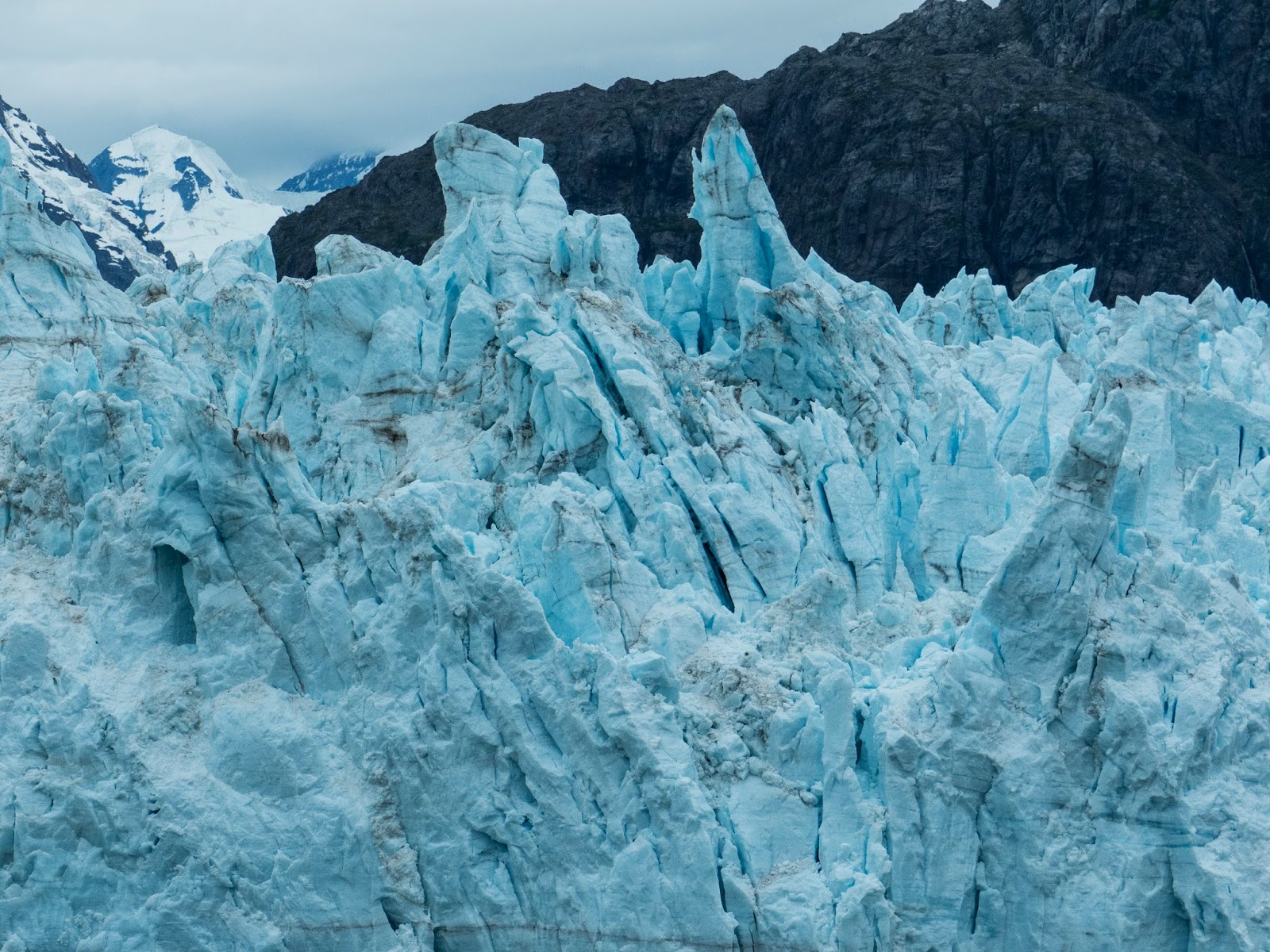


Glacial Ice


Grand Pacific Glacier


Our flight back to Juneau was spectacular as the pilot dipped his wings as we went through the mountain passes affording us panoramic views of the Chilkat Mountains.


We had dinner at the Red Dog Saloon which is an original landmark from old time Juneau where Rag Time Hattie used to play the piano in her white gloves and silver dollar halter top. At one point in the territorial days, they would meet a boat with a mule which wore a sign saying, "follow my ass to the Red Dog Saloon." We picked up a bag of "Tim's" potato chips which they serve there and headed home exhausted!


The next day was a little more low key. We went back to the Mendenhall Glacier and hiked out to the Nugget Falls.

In the afternoon, we took the tram up Mount Roberts above Juneau from which we had great views of the harbor, but really wasn't worth the trip for the overall experience. On to the Alaskan Brewery to end our trip to Juneau. Lots to do and I think we did it all!

Monday, July 14, 2014

Petersburg

Petersburg     July 11th to the 14th

The M/V Taku didn’t arrive at the dock in Wrangell until after what was supposed to be our departure time of 11:30pm, so we got a late start on our 3 hour journey to Petersburg.  I napped for a short while and then joined Tim on deck to see the ship find its way through the Wrangell Narrows. The Narrows can only be sailed by the ferries at high tide and at some points are just wide enough for the ferry to maneuver through. We had come up through the Sumner Strait into the Narrows quickly, but now the ship had slowed through the passage with Mitkof Island to starboard and the Krupeanof Island to port. There was a full moon casting its reflection on the glass like water and the skies were much lighter than I was expecting because there is almost 18 hours of daylight here in the summertime. The ship moved with the slightest whooshing sound but the wind was strong on the foredeck. With most of the passengers asleep and those that were up and on deck extremely quiet and talking, if at all, in whispers, it almost seemed  like we were on a ghost ship!
Wrangell Narrows at Night
As we neared Petersburg, the red and green lights on the channel markers were flashing everywhere.  One of the crew was at the bow communicating with the captain on the bridge and Tim and I were thankful we were not doing this in the fog, as, I’m sure, was the Captain. We had to wait outside the harbor entrance while the M/V Matanusca left the channel on its way out of Petersburg. Two ships that passed in the night!
Passing the M/V Matanusca

We arrived safe and sound in Petersburg on Mitkof Island about 4am and drove straight to the National Forest Service campground, Ohmer Creek, about 21 miles out of the town back down the Mitkof Highway which runs along the Wrangell Narrows that we had just traversed to get to Petersburg. We were surprised to see that it was totally empty as had been the one on Prince of Wales Island. Posted on the board was the fact that this one was no longer maintained due to budget cuts so there was no water or bathroom facilities. Okay with us.. we carry what we need with us. We took the site we liked and went to bed. After a few hours sleep, we went to town to the visitor center and got information from the Fish and Game Department for Tim’s fishing excursion which included getting a King Salmon permit for 3 days.  
Petersburg Harbor

By then, the day had moved along so we explored the coast a little more, came back and lit the fire and enjoyed the solitude. The next day, I dropped Tim off at Blind River Rapids where the King Salmon were running and I drove to town to do the recommended tour of the Eagles Roost and Sandy Beach as well as stopping at different turnouts for views of the mountains and the harbors. I spied only one eagle, but I could hear more up in the trees.
Eagle's Roost
Mitkof Island is 23 miles long and only 16.5 miles wide with its highest elevation at Crystal Mountain which is 3,317 feet high.  Petersburg is known as “Little Norway” because a lot of the residents can trace their ancestry to the Norwegians who followed Peter Buschmann (hence Petersburg) here. The waterway with snow capped mountains had reminded them of home.  It’s a quaint little town with a population of about 3200. It’s main source of income is fishing in 2012 it was reported that the community generated $50 million in fish landings. It was ranked 20th nationwide in millions of pounds (52 million) landed. It is carrying on the tradition started 2000 years ago by the Natives of Tlingit (click it) Indians on Sandy Beach. The cannery is owned by a Seattle based company called Icicle Seafoods, Inc. The town is growing, though, as evidenced by the newer, larger buildings and the airport that are all located a few miles from the downtown area.
As in all of the Islands we have visited so far, there are many deer that appear along the roadside. Here we saw a young buck with its velvet horns still intact as well. We watched for a Brown Bear that we were told is in our camping area, but we never did see him. 
Buck with Velvet Antlers


Tim had a very successful day of fishing. He caught a King Salmon which was 32 inches long. He said it was the biggest caught by the group of fisherman out at the rapids that day. We cooked it for dinner and it was delicious. We’ll have enough for probably 6 more meals of Salmon!
Fishing at Blind Rapids

King Salmon at last!

We didn’t have the same views from our campsite that we had in Wrangell, but the ones downtown and across the water were every bit as good.
 This has been a relaxing and comfortable stay. The weather has warmed up and the rain has stayed away. The mosquitoes that I mentioned we had in British Columbia have not followed us in an extreme a fashion throughout our travels thus far in Alaska. Let’s hope that trend continues!


The Tongass National Forest

The Tongass National Forest

We have been in and out of the Tongass National Forest, designated as such by Theodore Roosevelt in 1907, since our trip into Hyder, AK and up to Salmon Glacier. It is almost 17 million acres and is the largest National Forest in the United States and the largest contiguous temperate rain forest in the world….thus all the rain we have been having!  It is estimated that more than 900,000 people travel through this forest each year while about 75,000 Alaskans call it home as do over 5,000 Brown Bears. They all depend on the forest for their livelihood whether it be from fishing, timber or its minerals.  In the 17 million acres there are 19 designated wilderness areas for a total of 5.8 million acres. In addition, it offers over 400 hiking trails, about 150 recreational cabins and 13 campgrounds, which we have used frequently. In it, we have seen glaciers, mountains, valleys, estuaries, islands, lakes, and miles and miles of shoreline but no bears as yet!


As you can imagine with all the rain, it is a beautiful, lush and verdant area with spectacular vistas of its mountains and glacial cirques. We anticipate enjoying more of the forest all the way up the Inner Passage through Sitka, Juneau, Gustavus, Glacier Bay and on into Skagway and utilizing its wonderful, peaceful camping sites.

Wrangell Island

Wrangell Island   July 9th and 10th

Our ferry ride to Wrangell was a night passage from 10:45pm to 5:15am on the M/V Matanusca which is the same ship we took from Prince Rupert to Ketchican on our first leg of the Inner Passage. We slept in the recliner lounge which was quiet enough bar the continuous drone of the engine. When we arrived there we stopped at the boat harbor that offered parking for RVs and I promptly fell asleep for a few hours while Tim went and explored the National Forest Campground at Nemo Point which was about 14 miles south of the town on Zimovia Strait. Originally, we thought it might be too far from town, but we were thrilled with this campground and its location. It had 3 sites all very large and extremely well done and maintained by the Tongass National Forest Service and was free. The site we chose over looked the strait with spectacular views of the mountain range in all directions. We were in Wrangell from early on the 9th until the ferry departure at 11:30pm on the 10th so we had plenty of time to explore this island and sit by the fire and just enjoy the views. The weather was cooperating and the rain was nowhere in sight.

Campsite at Nemo Point


The town of Wrangell is located on the northern tip of Wrangell Island which is about 30 miles long.  It is the only town in the state of Alaska that has been ruled by 4 different nations. The Tlingit (clink it) Indians, Russia, England and the United States.  It was first formed as a trading post for the Tlingit and the early settlers and was incorporated as a town in 1903. Most of the original town was ruined in 2 different fires first in 1906 and then in 1952 so much of the town has been rebuilt. We were told that the population has declined from about 3000 to a mere 1500 due to government regulations on fishing. Fishing is the major industry with Salmon then halibut, shrimp, crab and herring as its mainstay. The timber industry is fairly small here while tourism is increasing. There is a huge cannery with hundreds of large refrigerated containers for shipping fish off the island on barges.  
Wrangell Harbor

We saw several tour companies touting excursions to Anan to see the bears and to the Stikine River and Leconte Glacier.  The Stikine (Stick EEN-means Great River) River is said to be the fastest free flowing river in North America. It is 330 miles long through British Columbia, where we first saw it, through mainland Alaska. It opens out into the Pacific Ocean just 5 miles north of Wrangell. The Stikine/ Leconte Wilderness area was established in 1980 and is a very popular place for the tour companies to explore. We had not planned a trip here, so we were unable to go up the river to the LeConte Glacier but we could see it in the distance and we will be seeing many more as we continue our journey.
View from Campsite

There are very few cruise ships that come in to Wrangell and the only sign that we saw of catering to the adventure cruise ship passengers now in the harbor was a young lady selling garnet stones. She has a list of when these adventure cruises come through and she sets up her stones to sell. The first published report about the “Wrangell Garnets” was in 1906. In 1907, the all-woman Alaska Garnet Mining and Manufacturing Company based in Minneapolis became interested in the area after seeing an article in the Wrangell Sentinel about them. They applied for a patent, got it and started mining for the garnets. They made and marketed things like watch fobs and garnet pins. The activity dwindled through the 1920s and, in 1936, the company was sold to Fred Hanford who in turn deeded the ledge to the Boy Scouts of Wrangell in 1962. The only stipulation was that the land must be used for the sole purposes of the Boy Scouts and that the children of Wrangell be allowed to take garnets from the ledge. If an adult wants to go there, a child must accompany him/her. The local Presbyterian Church now has oversight of the Ledge for the children’s benefit. To this day, the children have free use and go by boat  7 miles up the Stikine (Stik EEN) River to the Garnet Ledge to mine for garnets. Some are still in the stone when they sell them. This young lady told us how it is difficult to get them out in one piece without them falling apart. The children save their money and some have used it towards college tuition.  Yes, of course, we purchased a small garnet..how could we not?
Wrangell Harbor
We explored the harbor as well as the Petroglyph Beach where we say a few markings on the rocks. The majority have been worn away with the ocean motion. The petroglyphs we had seen in the west two years ago were very pronounced and these were hard to see.
Pats Lake
We also went to Pats Lake and even tried the strait where the used and abused ships have been left to rot to check out fishing opportunities to no avail. No fish in those waters!
Wrangell Harbor

We drove the Nemo Loop partially around on gravel roads through the Three Sisters Campground/Overlook, the Anita Bay Overlook, the Highline and the Turn Island Beach and decided the entire loop would have been too much in our little Fit. The views, once again, were wonderful.
Sunset on the Harbor  Waiting for 11:30pm Ferry


Once again we have squeezed a lot of sightseeing into a small window of opportunity. Wrangell is a lovely Island. We’re glad we made this one of our stops along the way. 

Ketchikan, AK

Ketchikan  July 7th

We returned from Prince of Wales on the 7am ferry so that we had most of the day and all of the next to tour Ketchikan. Ketchican is on the southwest coast of Revillagigedo Island accessible by boat or plane only. The only other community on the island is Saxman which is south of Ketchican with a population of 434 while the population in the borough of Ketchican is over 13,000.  It was raining off and on as it had been for a few days, but that didn’t deter us too much. We parked in the Walmart parking lot again for the one night we would be there. They are very welcoming to RVers as they know we will be going in to the store to buy our supplies.
Creek Street Downtown Ketchikan
Ketchikan was started in 1883 when a Mr. Snow built a salmon saltery there.  The fishing trade flourished and soon the mining and logging industries developed. , Ketchikan grew rapidly from a population in 1900 of 800 to what it is today.  Today fishing and logging are the two mainstay industries.  The tourist business has now added a new industry to the area. Our first day downtown, there were 4 cruise ships in port, each probably holding 4000 people or more. The place was packed! The dock area and shops are well done to handle the masses with many gift shops, galleries, cafes and the like, but it was a little overwhelming for us after being on Prince of Wales for almost a week with its minimal population. We strolled in the rain a little and called it a day.
Dock in Ketchikan

The next day there were only 2 ships in port and drizzling slightly so it was much easier to get around. We went to the old historic district, Creek Street, watched fish literally jump out of the river while being chased by a seal and talked to some children fishing off the bridge. It was great fun!
Fish Ladder
 We saw the fish ladder in the river which was built to help the salmon swim upstream against the rushing river. 


We also toured the Totem Pole Museum while downtown which gave us more history on the Tlingit, Haida and Tsimhian tribes. The Totem Poles were not idols as some of the earlier settlers thought, but rather were built in honor of their ancestors and deceased immediate family members.
 In the afternoon, we drove to the other end of the island on the main road. We were told that from the City Offices there are 17 miles of road to the north and 17 miles of road to the south. We covered most of them and saw the airport on another island across the harbor and more float planes then we could count kept taking off and landing in the strait.


The sightseers didn’t have much of a view with all the fog and rain, but they had probably booked this tour well in advance or on the ship. For any future cruisers of the Inner Passage, I would advise them to wait until they get to a port to see what the weather is like before they book any tours. Trust me there are plenty of tours available, especially in Ketchikan.

There is a saying in Southeastern Alaska that rubber boots are their flip flops! Truly, most of the citizens we have seen in all of the ports starting in Prince Rupert, wear rubber boots. The rain fall, or so we were told, in this area is over 12 feet (yes feet) per year! So winter or summer, long pants or shorts, boots are the preferred footwear. Our rubber boots didn’t come out, but we did wear our usual hiking shoes for warmth, comfort and to keep our feet dry as well.


Monday, July 7, 2014

Prince of Wales Island. AK

 Prince of Wales Island July 2nd to July 7th        
  
Only July 2nd    we returned to the ferry dock in Ketchikan two hours ahead of boarding to get our tickets, get in line, and wait for boarding ferry to Prince of Wales Island. This Island, as well as nearby islands, were first settled by the Tlingit people. From the literature, we learned that they were the most wide-ranging of the Southeast Alaskan tribes and were “adept at trade with inland Natives and with Haidas and Tsimshian.” It is thought that the Haidas established settlements on Prince of Wales sometime in the 1700s. They came from Haida Gwaii, previously known as Queen Charlotte Island of BC’s northern coast. Archaeologists have found artifacts that they believe date back to as much as 10,300 years ago. There are petroglyphs on several coastal rocks but they do not divulge the location to the public to protect them from vandalism.  There are Totem Pole parks, fishing villages, and native Alaskan cultures thriving on this island and we hoped to visit some of the Totem Pole parks such as the one in Klawock, pronounced (kloo-wah).
Totem Pole in Klawock


While we were waiting in the ferry line, Tim struck up a conversation with two couples already in line and began talking fishing. It seems that one of the couples, Bill and Lee, has been going to the Island for years to fish. They had a pickup camper and were towing a boat. The other couple, Frank and Linda, had been there before and knew Bill and Lee. They had a pickup with their tenting supplies. Each couple had also brought a large freezer to take home their catch! During our 3 hour ferry ride, we spoke to them some more and got the lay of the land on the Island. They were headed to Coffman Cove on the northeast shore and suggested we follow them there to Oceanview RV Park.

Meanwhile, the ferry ride through this section of the Inner Passage was a little rough but the scenery was worth getting our sea legs back. No whales on this passage, but the islands, the fishing boats, shoreline villages and lighthouse views made for perfect backdrops for the cruise ship passing by.


I was told upon exiting my car on the car deck that I would have to be the first one off the ship so they could clear the way for the walk on passengers. Fifteen minutes before landing in Hollis, I had to go down and get ready to drive off. As we came nearer the dock, they opened the door and I was looking out directly at the pilings as we swept past them. I’m glad they had the wheels blocked so I wouldn’t go rolling off! Then came the dropping of the ramp for exiting. Sitting there I swore it was going to land on the hood of the car.


All my worries were for naught, they landed, I drove off and met Tim a little ways up the road to hook up the car to the RV.

Originally, we were going to get off the ferry in Hollis, park the RV in the closest campground and then tour the island in the car. We weren’t sure of road conditions on the island and didn’t want to get into rough gravel roads with the RV. As it turns out, Prince of Wales Island has some of the best road conditions in Alaska and they are improving them every year. So, we decided to do the 80 miles to Coffman Cove. And we are very glad we did!

We arrived at the campground and were thankful that at 9:50pm we still had daylight get situated and help Frank and Linda unload and get their tent set up. The campground is right on the water and the little town is a ten minute walk.

The first day, Tim and I walked to town while the others were busy setting up for their longer stay here. (Bill and Lee stay a month while Frank and Linda will be there 2 weeks.) There is one store, a health clinic (new last year), a post office, an elementary school, a city hall, a library that doubles as a “take and bake” pizza parlor, a take- out restaurant, a bar, a lodge and a large marina with many fishing boats. We met some folks who told us the population in winter is 100 and swells to 200 during the summer with a few folks drifting in and out (like us). We were impressed with the maintenance of the buildings and some new construction with what looks to be in floor heating going in. The locals told us that the winter isn’t too bad..16 being their lowest temperatures and only 4 -6 inches of snow at a time, but a lot of the residents are only here in the summer.  The weather now is in the 50s with winds off the water making it pretty chilly. I brought out my wool crew hat and gloves and warmer jacket!
View from Campsite


Bill and Lee seem to know just about everyone in town and have fished with them all for many years. When we strolled down the docks again in the afternoon, we watched three teenagers filleting huge silvers (salmon) so skillfully. Lee explained that the young lady had been doing it since she was 9 years old!

On the second day, July 4th, Tim was invited to go fishing with all of the others in Bill’s boat while I stayed back in the warmth of the RV.  The weather turned nasty on them and it took an hour an a half to get back from their 20 minute jaunt out to Whale Pass. Thanks to the good job that Captain Bill did it wasn't any longer.
Coming In from Fishing
Most of of the town folk were in the parade, so it left very few people on the sideline.  We enjoyed our stay here, but decided we needed to see the rest of the island as well, so we hooked up the car and headed back to the Harris River campground in Hollis. This campground was completely empty when we arrived and only 2 more groups of tent campers came in the next 3 nights.

In the next two days, we toured through Hollis, Craig, Klawock and Thorne Bay. Craig is the largest of these with a population of over 1000, Klawok has about 850, Thorne Bay has 495 and Hollis has 163. The two main industries on the island are fishing and logging. In the past, mining was also done in Hollis. All of the towns have docks, schools, and libraries,and some have float plane capability, medical services, and grocery stores. Island living here is quiet and relaxing..except for the 4th of July and its fireworks that is. 
Lots of Deer along the road

Klawock

Craig

Thorne Bay
Tim Fishing
Klawock Library
View from Island Road
There are not many visiting RVers on the island. In fact, we were the only RV on the ferry both to and from Prince of Wales.  Exploring the out of the way places is what we came up here to do, so I guess we're on the right track!  
Tim in RV boarding Ferry
Patch of Blue on Grey Day


Our ferry ride back to Ketchikan was uneventful and once again we stayed at Walmart awaiting a ferry tomorrow night to take us to Wrangell.