Wednesday, September 10, 2014

Whitehorse and Watson Lake in the Yukon Territory

Whitehorse and Watson Lake August 28th and 29th

We stayed just one night in Dawson City and took the Klondike Highway  which followed the Yukon River down in to Yukon’s capital city of Whitehorse. Whitehorse was also booming during the 1898 Klondike gold rush. Once the Skagway and Yukon railroad was completed, this town became the connecting point between the trains and the Yukon River Paddle Wheelers.  It is now a city of over 27,000 with small town charm and a lovely waterfront walk. The  Yukon Highway views are below.


Watson Lake

The following day we continued down the scenic Alcan highway  to the Watson Lake where the famous Watson Lake Sign Post Forest sits. It started out with a lonely U.S. soldier posting a signpost to his home town in 1942. Today there are over 77,000 signs hammered to row upon row of posts. We had brought license plate from our home town of Bluffton with us, but decided to additionally buy some wood from the hardware store and make one of our own to hang up.


If you ever go there, ours is just slightly to the right of the Arch Way on the first row  of signs about knee high.
We were lucky enough to find an empty spot. The Visitor Center folks take care of the signs and never remove one unless it has deteriorated so badly that you can’t read it any more. I think ours will last a few years anyway.

Top of the World Highway and Dawson City

Top of the World Highway August 27th 

We left Chicken behind and started out on the “goat path” as the locals called it. This is a narrow dirt road, muddy at times, with lots of construction vehicles on it as well. It has very soft shoulders and deep drops off the high curves. We originally were not going to take this road, but talked to several other RVers along the way who had done the drive and told us that it was not as bad as it sounds.  So off we went.


It was as advertised but did not have as many pot holes as we thought it would. It was definitely a challenge but well worth it in the end because the rest of the Top of the World Highway gave us such fantastic views and a feeling that we were above it all. Absolutely wonderful!During our travels on the Top of the World Highway we crossed into the Yukon Territory.


Dawson City


The journey for the day ended in Dawson City after we took a ferry across the Yukon River.

Dawson City still had dirt (mud) streets with wooden sidewalks and the old gold rush type of buildings. There are still many gold mines being operated in the area.  The rock pile remains of the gold mining operations line the street on the way out of town for about five miles.  The population is a little over 1700 and increases during the summer months with all of us tourists passing through. This was a booming “Klondike gold rush” town with miners coming up the Yukon River and over the Whitehorse Pass from Skagway.

Thursday, September 4, 2014

Chicken

Chicken August  25th and 26th

We left Fairbanks fairly early so that we could get through Tok on the Richardson Highway then pick up the Taylor Highway to Chicken. The road was good with a few exceptions of patch work until the last couple of miles or so when it changed to dirt with soft shoulders and began to get a little narrower.  

We arrived after about an 8 hour ride which was longer than we have been doing in Alaska. We were not overly surprised to see what Chicken looked like as friends, Jill and Bob, and others had told us that there is nothing here.  Still, you need to see Chicken to believe it.
Town Statue
There are four areas of buildings.  Two of them have RV parks, stores, and cafes. One of these used to be the original gold mine in Chicken. The third area is called the Town Center.
Camping in Chicken 

The Gas Pump
The Town Center
The buildings look to be falling over and when you walk inside, you are walking atilt. The fourth area is the Post Office which is on its own dirt road just outside of “the town.” The mail comes and goes on Tuesdays and Fridays in the summer time and when it can in the winter.
Post Office

 Evidently, years ago when it was founded it was a gold mining town and the folks wanted to name it after the state bird, the Ptarmigan, but they could not agree on how to spell it, so they called it Chicken instead. There are chicken signs everywhere and everything that is here references hens and roosters with the exception of the gold mining. There are still private gold mines on the Forty Mile River which is close to here and people come up and mine their claims all summer. They have pans and gravel here so you can use one of their pans and try your luck. The gold is in the gravel they tell us. Tim tried with only two specs of gold for his 2 hour effort.


The population of Chicken in the winter months is three- the postmistress and her husband and one other hardy soul. The State stops maintaining the road up to Chicken on October 15th. After that, they use snowmobiles for getting around, I presume.  In the summer time, there is lots of traffic through here up from Tok through Chicken to the Top of the World Highway and into the Yukon Territory in Canada (40 miles from Chicken) and vice versa. The Top of the World Highway is said to be quite a ride! Dirt or, most likely, mud with all the rain we have had, with a lot of potholes and wash boarding and very narrow. We’ll let you know how we make out on it after our trip to Dawson City, YT tomorrow.  

Fairbanks

Fairbanks August 22nd -August 24th

The ride from Denali on Friday the 22nd brought us over the Parks Highway to Fairbanks. This region is referred to as the Interior of Alaska. The topography has changed in that we have sweeping views of valleys with mountains in the distance. We had been at the base of the mountains for a long while traveling through Valdez across Prince William Sound into Seward and up into the Kenai, then Talkeeta and into Denali. Very different feel for Alaska.

We got our supplies at Fred Meyers, of course, and then traveled about 15 miles out of town to the Chena Recreation Area where we camped for two nights. The third night we stayed at a little lake near Eielson Air Force Base another five miles down the road.

While we were in the Fairbanks area, we drove the 63 miles to the Chena Hot Springs that we had heard so much about from our friends and other travelers.  The water was nice and hot but the algae on the rocks were disconcerting. It definitely is natural hot spring water, but it is fed into a man made cement lined pool with gravel on the bottom and large boulders around it.

We were expecting a totally natural hot spring. We only stayed in about ten minutes, showered and had lunch in their restaurant. We decided to go to the Ice Palace in the downtown area instead of the one at the Springs. That was a mistake from what we have heard. The one at the Hot Springs is supposedly done a lot better with large ice sculptures, an ice bar and “appletinis” if you so desire. The one in Fairbanks was a joke. We watched a movie which, while capturing their ice festival activity, was much too long. We then were  allowed to walk through 4 small areas where there were some sculptures that look like they were done a very long time ago. From what we saw, we did not think that they were all that well done. Waste of time and money here.

The Visitor Center downtown is very worthwhile with their exhibits and the Alaska Geographic store to browse through.

Another time,  we drove over to the North Pole, which is a little town outside of Fairbanks and purchased Santa letters for two of our younger grandchildren.  Christmas everywhere…from Santa House to Santa himself in the form of a large statue outside. I’m sure the children will be excited when they receive their letters the first week of December.


From there, we went to tour the Gold Dredge 8 Park. The Gold Dredge 8 is a mechanical gold pan that operated from 1928 to 1959. We rode on a replica of the Tanana railroad to the “base camp” stopping at exhibits along the way where Yukon Yonda explained what we were seeing. We were given “poke” sacks and taught how to pan for gold.  We only got a few specs which they weighed and told us it was worth about $8. The most anyone has ever gotten on a tour such as this was $300 worth.

Interior Alaska is still a productive gold mining region. There are a lot of small placer mines, which means they are extracting gold from creeks using water and a sluice-box and pan. There are also three world class open pit hard-rock gold mines currently operating or are being built within 50 miles of Fairbanks.
The information given us states, “The major producers of gold are South Africa, the United States, Australia, Canada, Latin America, China and Ghana. The U.S. produced 230 tons of gold in 2012, of which 80%came from the state of Nevada. In 2010, 8.9% of the world’s production of gold came from the United States.” It also states, “Today, the World Gold Council estimates about 23,000 tons of gold are recovered worldwide annually, having doubled since 1980.”

We also stopped along the roadside to view the Alaska Pipeline up close. It runs above ground until they have to put it under the ground for a road or a caribou migration path for instance.

We finished the day strolling through Pioneer Town which is a replica of old time Fairbanks. They have moved a lot of the original log houses to this area and are being used by artisans selling their wares. Nice park to wander through for a short while and a great place for children to run and play on the carousel.   

One of the tourists on the Gold Dredge tour had told us she and her husband  saw a little of the Aurora Borealis the previous night, so we thought we might get a chance to see it that night. I had my camera all set and Tim had the alarm clock set for 2am, but the rains returned and washed that idea right out of our minds.  We needed the extra sleep anyway! 

Friday, August 22, 2014

Denali National Park

Denali National Park   August 18th, 19th, 20th, 21st

We drove the Parks Highway to Riley Campground just inside Denali National Park. While we have not been making campground reservations for the majority of our trip, we thought it best to do so here and we were glad we did. The campground is full  every night and were we not able to get in here, we would not have been happy in a commercial one outside the park, behind the gift shops in a parking lot..

Tundra Wilderness Tour

On the 19th, we took an eight hour round trip wilderness tundra ride on a school bus to Eielson Visitor Center which is 65.9 miles into the Park. The first 15 miles were paved and two lane. The next 10 miles were gravel with two lanes and the rest was a  gravel one lane road with pullouts for oncoming traffic to veer off and let you pass.
One Lane Road
Sure glad we weren't driving our RV on this road! We brought our lunch to eat on the bus for this long day. We anticipated seeing a lot of wildlife. We did see some and were happy with the trip overall but greedily we wished we had seen more of the animals up close and personal. We couldn't get off the bus unless we were at a rest stop, but we were able to take pictures out the top of the open windows. We were dressed in warm layers once again for the rainy and cool weather. Among the animals we saw were two grizzly bears, many caribou, one moose and one Dall sheep and one two legged animal who was waiting for our bus to move so he could get more pictures of the sheep.
Grizzly
Dall Sheep
Female Caribou on Road
Male Caribou
Grizzly
Two legged animal
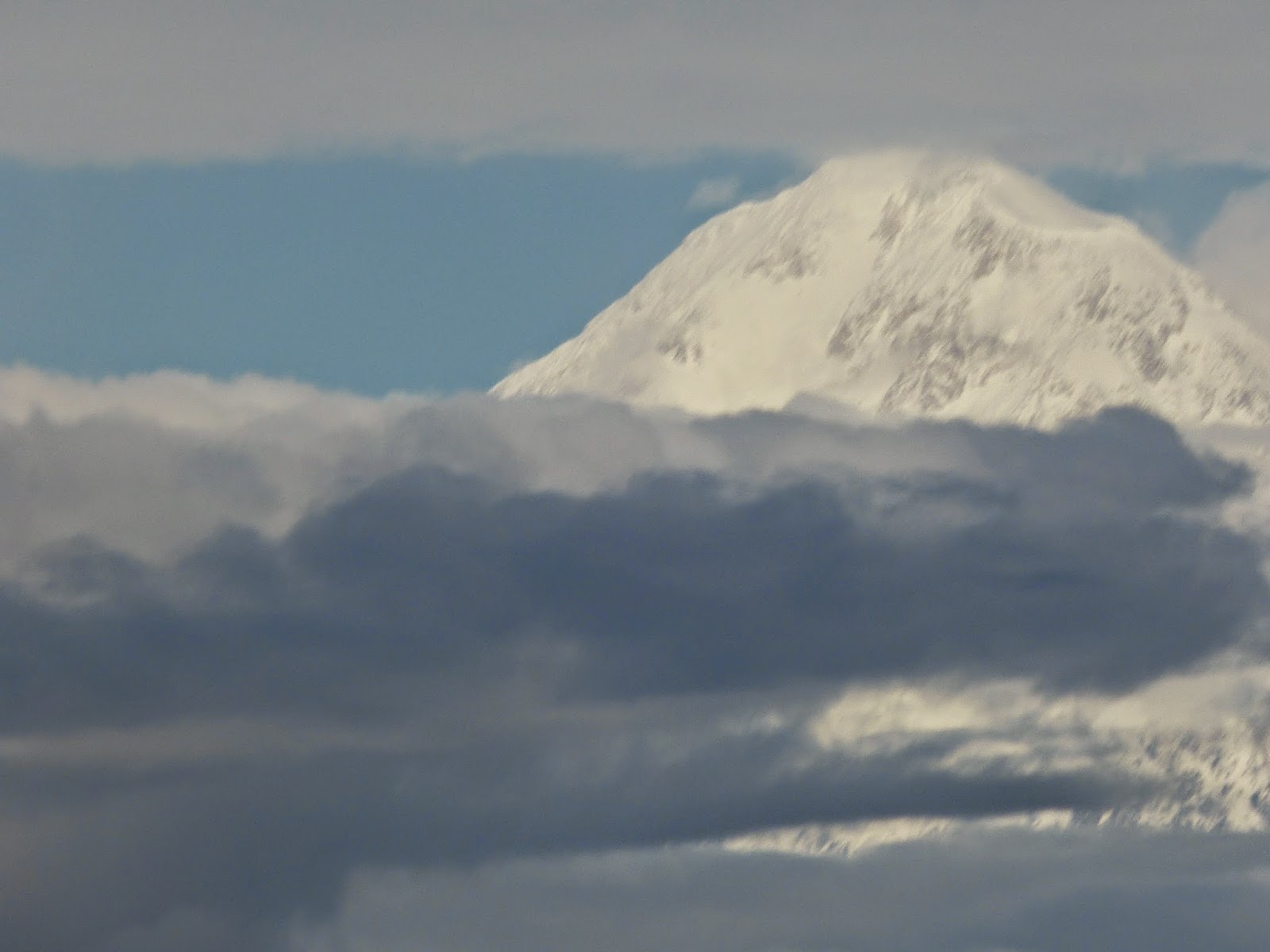
We kept trying to see Mt. McKinley again but to no avail. There are only a few places on the road that you would be able to see it were it clear, but it wasn't.  The vistas were wonderful and you could really see the "braided river" effect that happens here.
Photochrome Point

Vista
Low Cloud Cover
Friends of ours, Marlette and John, and their traveling companions who we also know, Bev and Dave, Denise and Rich from Connecticut were on a tour with Celebrity and Marlette had sent me their itinerary. They would be in Denali for a day at the same time we would be. And, they were taking the afternoon wilderness tundra tour while we were taking the morning one on the same day. On the way back down from Eielson, we stopped at a rest stop and there they were. What are the chances! We made plans for breakfast the following morning at their lodging before they leave for Anchorage. It was great to see them.
Marlette and Kate

John, Marlette, Kate and Tim
White Water Rafting Trip

After breakfast on the 20th, we went back to the campground to change clothes and get ready for our white water rafting trip down the Nenana River. We dressed in layers as instructed and made sure we had our extra socks and headed out for our afternoon of fun.

The company, Explore Denali Rafting, expertly fitted us into dry suits with neoprene booties, made sure we had our life jackets on, and hats and gloves to keep us warm. The water in the river is about 36 degrees so you really couldn't go without all of that equipment and stay warm by any stretch of the imagination.

We walked behind their shop to the river, loaded into the boats and we were off. James, our oarsman, was quite a character and definitely knew what he was doing. As we crossed over the first of many Class III and IV rapids, the company had a photographer on the shore taking our pictures..many of them you will see here.
Wave Everyone!


I also brought a waterproof disposable camera with us and took pictures when I was able to let go, but those won't be on this blog. On one of the very first rapids, I got hit extremely hard by one wave that caught me full on my face and gave me an instant "brain freeze" headache like the kind you get when you eat ice cream too fast, which, fortunately, only lasted a few minutes!  It was a total of 2 hours on the water with many exciting moments. One of which was when the kayaker, Jay,  from the company who was traveling with the rafts attempted a pass through a dangerous rapid called "the knife."

The rafts did not go through the narrow part and were already down the river just a little bit when he attempted the narrow passage. The Guide in the other boat, Wayne, yelled that the kayak had flipped and Jay was not any where to be seen. James was quite concerned and tried to row back up the river which was impossible. Both rafts eddied out to the side of the river waiting to see if he would reappear. After a long, tense five minutes, Jay came around the bend in his kayak. From what we could gather, his kayak flipped and he had to remove the skirt over the opening to get out, but there was a lot of wood (trees and brush) that he got entangled with under the water. He was able to hold onto his paddle and retrieve the kayak once he got himself free of debris. He also cleared out some of the wood and completed the passage from start to finish. He performed amazing feats in the kayak!

Our clothing stayed dry and the heater was turned way up on the bus on the way back to their shop. We had done some white water rafting in Vermont years ago, but this river was much faster and the rapids were much larger. What a great time we had!

On our last day at Denali, the sun came out just in time for us to do our laundry, download photos and write this blog!

Talkeetna , Mount McKinley, and Train to Hurricane Gulch

Talkeetna August 16th and 17th

Our arrival in Talkeetna was under stormy skies once again. We have had rain for a portion of almost every day in Alaska thus far. But, the flowers are beautiful!

We stayed at the Talkeetna Boat Landing and RV Park on the Talkeetna River. The first day, we explored the downtown area. The streets were very busy because not only do the cruise lines bring folks here on buses, there is also a train that stops here from Anchorage and Fairbanks. Charming little place really with its restaurants, gift shops, tour companies and street vendors. They say that on a clear day at the end of the street where three rivers merge; the Talkeetna, the Susitna or "Big Su" as the locals call it, and the Chulitna, you could see Mount McKinley. No luck today. (The na at the end of each of these rivers means water in the native tongues.)

Mount McKinley (or Denali as the locals call it) August 17th

We checked out several flight seeing companies and opted to do a flight on the 17th with Talkeetna Air Taxi to see Mount McKinley as we are sure we won't be seeing it from the ground.  Sure enough, it was raining again and our flight was to be at 8:30 am. We checked with the company and they told us it looked good for landing on the glacier today so off we went hoping for the best. Some people from the tours the day before told us that they went up but couldn't see the mountain very well and couldn't land. The company would refund the landing part of the flight if unable to land, but it would be very disappointing.

It was still raining when we took off but as we rose above the clouds the skies were blue with cotton candy white clouds. The vistas were breathtaking! The pilot told us that only 20-25 days a year they get a day like we were having to be able to see so far and actually see the top of Mount McKinley which stands at over 20,000 feet and is the tallest peak in North America.

We crossed the Alaskan Range to the northern stretches of the 6 million acres of Denali  National Park. The pilot banked and looped through the walls and crevices with the wing tips not far from the sides of the mountains. We flew up to the front of Mount Foraker, behind Mount Hunter and to the back side of McKinley to see the Wickersham Wall, which is a 14,000 foot wall on the north face of McKinley and one of the largest walls in the world. We then rounded McKinley to the south side and descended into the landscape surrounding  the Don Sheldon Ampitheater,  soared through the Great Gorge and into the "gargoyle" at the head of the Ruth Glacier where we landed at about 6000 feet. Unbelievable!


After about 20 minutes on the glacier, we took off and veered to the right and most of us gasped as it looked to us that we would not make it through the two mountains with the wing tips so close to their walls. The pilot knew what he was doing, of course, and we flew back over a plane that landed exactly where we had been just minutes before. Tim had the opportunity to ride in the co-pilots seat on the return trip and was thrilled to do so.

Our Shadow below
This was definitely the best two hours and the highlight of our trip so far. We were so privileged to see what so many come here to see and don't because of the weather conditions. The pictures tell the story!

Train to Hurricane Gulch August 17th

Yes, we crammed one more thing in to the day. We took the Hurricane Turn Train ride that took us through the back country where folks can get off where they want to and just flag the train down to get on it.
The Conductor
Hurricane Turn Train
The train travels north from Talkeetna along the Susitna River and through the Indian River Canyon ending in a ride across the Hurricane Gulch Bridge. It travels through a wilderness that is only accessible by train and returns back to Talkeetna at the end of a six hour day. The characters getting on and off were quite interesting including, an elderly woman leaning on a cane on one side with a rifle slung over her other shoulder.
Note the Rifle over left shoulder
We also met Mary  T. Lovel and her husband at the Sherman City Book Store. Mary has written two books on pioneering in the wilderness in Alaska where she raised her family and still lives even though she is now in her late 70s or early 80s. They live 32 miles up the track and depend on the railroad, as do all of the inhabitants along this route, for supplies and transportation and their mail.
Sherman City Hall
Sherman City Depot and Book Store
Another author, Sharon Cartwright, came on board after waving us down. Sharon writes children's books and comes aboard to sign and sell them to the passengers. For Mary, the train stops at her "book store" on the return trip. We saw many travelers, hikers, and fishermen boarding and disembarking as well as a group of kayakers who hitched a ride up the river to paddle back to Talkeetna.
Hikers
Unloading Kayaking Gear
Not much wildlife along the route which was disappointing.The Discovery Channel features the Alaskan Railroad and this train route and an extension past the Hurricane Gulch Bridge on a program called "Alaska Railroad." We met the engineer who will be starring in the next episodes of the show. The railroad is extremely important for the way of life in rural Alaska.
Engineer on Discovery Channel Show
Mount McKinley from the Train